AOMORI
자연이 풍부한 혼슈 최북단 지역. 일본 유수의 폭설 지대로 독특하고 아름다운 경치와 문화가 매력적이다. 히로사키의 벚꽃, 아오모리의 네부타, 오이라세계류의 단풍, 핫코다산의 수빙 등 사계절 즐길거리가 풍부하다.Aomori is the northernmost prefecture in Honshu and full of nature. It’s one of the snowiest areas in Japan and has distinct beautiful sceneries. Different sights can be enjoyed in each season such as cherry blossoms in Hirosaki, the Nebuta Festival in Aomori, the autumn leaves at Oirase Mountain Stream, and the snow rime at Mt. Hakkodasan.
-

1. 네부타 축제 Nebuta Festival
도호쿠 3 대 여름 축제 중 하나. 손오공, 음양사, 귀신 등을 형상화한 거대한 대형 입체 등불 ‘네부타’가 형형색색의 빛을 발하며 행진한다. 뜀을 뛰듯 춤추며 행진하는 춤꾼 ‘하네토’의 우렁찬 구호가 축제 분위기를 북돋운다.
One of Tohoku’s 3 biggest festivals,Giant floats of the Monkey King, Onmyoji, and demons march through the streets emitting colorful lights. The energetic shouts of the jumping “Haneto” dancers rouse everyone’s spirits.
Google Map -
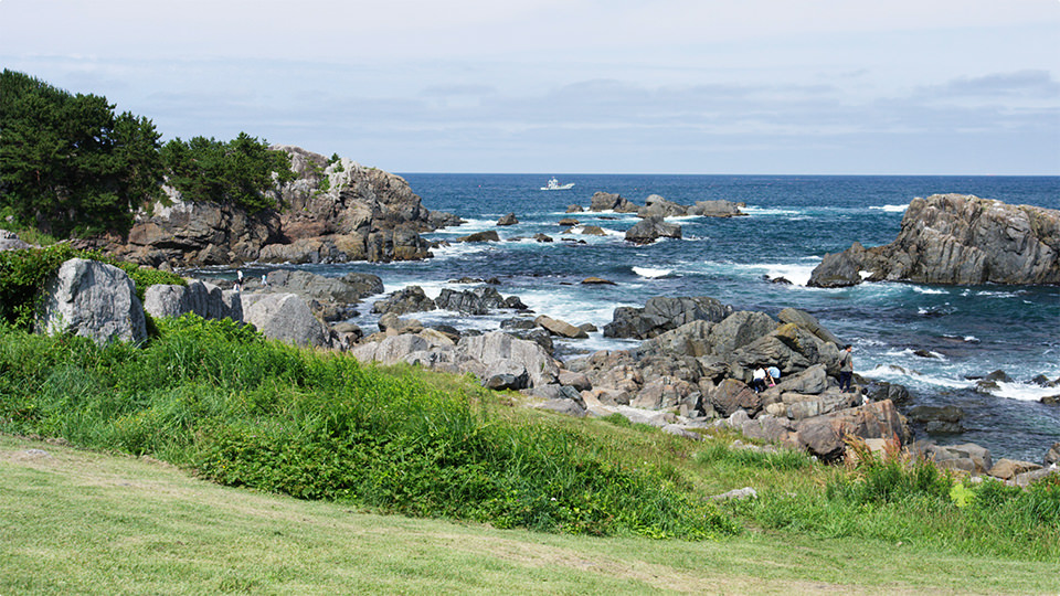
2. 다네사시 해안 Tanesashi Coast
약 12km 가량 이어지는 아오모리현 남동부 해안 지대. 해안가까지 펼쳐진 푸른빛의 천연 잔디밭과 거센 파도가 만들어 낸 하얀 암석 등 거대한 바위, 날아다니는 괭이갈매기, 도호쿠에서 손꼽히는 모래사장 등 한 걸음 내딛을 때마다 변화무쌍한 경치를 즐길 수 있다.
This coastal region extends for around 12km across the southeastern part of the prefecture. Take a stroll here and enjoy the varied scenery: natural bright green grass growing as high as the waves, giant white rocks carved by the sea, the dance of black-tailed gulls, and one of the best sandy beaches in Tohoku.
Google Map -
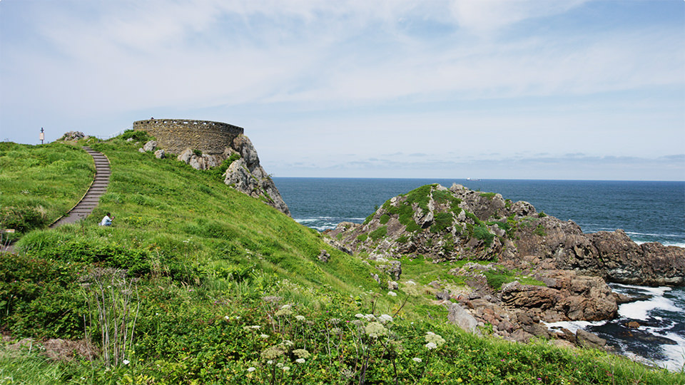
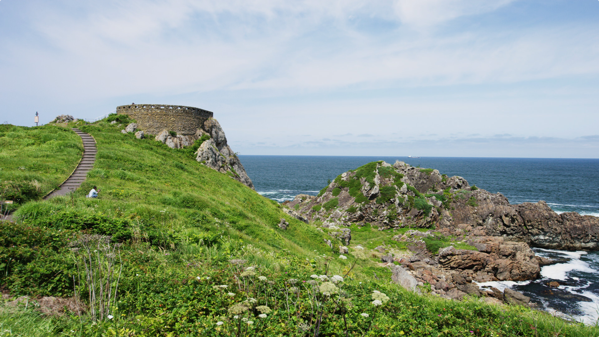
3. 아시게자키 전망대 Ashigezaki Lookout
에도 막부 말기의 흔적이 엿보이는 전망대로 마치 요새처럼 생겼다. 태평양을 향해 나있어 하얀 파도와 바닷바람을 느끼며 저 멀리 수평선까지 한눈에 바라볼 수 있다. 야생화가 만발하는 산책로도 인기있다.
See the vestiges of the end of the Edo Period from this fort-like lookout. Built like a walkway going out to the Pacific Ocean, it offers views of the far-off horizon along with white-crested waves and a salty breeze. The footpath blooming with primeval flowers is also popular.
Google Map -

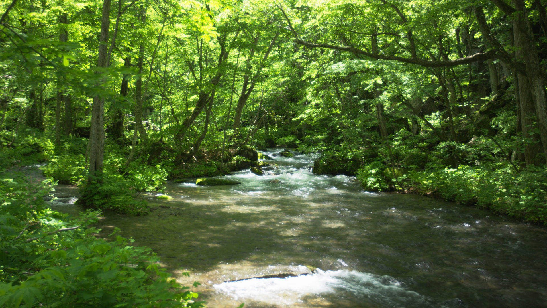
4. 오이라세 계류 Oirase Stream
울창한 자연림 사이로 약 14km 가량 이어지는 계곡. 나무로 둘러싸인 산책로를 걷다보면 수묵화처럼 매끄럽게 흐르는 강줄기, 이끼 낀 나무와 바위, 힘차게 쏟아지는 폭포 등 숨 막힐 듯한 풍경과 마주하게 된다.
This stream in a deep natural forest is about 14km long. Walk along the tree-lined footpath to see the breathtaking scenery of the stream flowing smoothly like a watercolor painting, with moss-covered trees and rocks and majestic waterfalls.
Google Map -

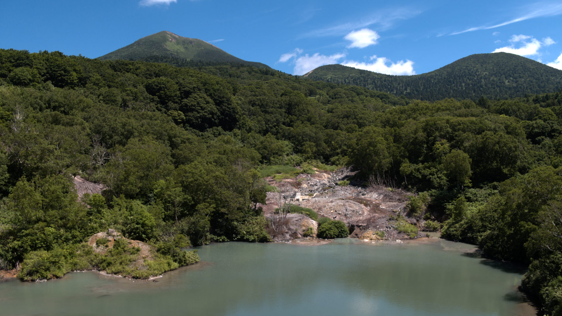
5. 지고쿠누마(地獄沼) 늪 Jigoku-numa Pond
격렬한 화산 폭발로 형성된 화구 습지. 온천수가 끊임없이 솟아나며 가장 뜨거운 곳은 무려 98 도에 달한다. 화산 지대인 핫코다 산맥을 배경으로 수증기가 피어오르는 모습이 열탕 지옥을 연상시킨다.
This crater pond was formed by violent volcanic eruptions. Its continuously gushing hot springs reach 98 degrees celsins at their hottest. The scene of thick clouds of steam rising in front of the Hakkoda Mountains looks just like the a hellish cauldron.
Google Map -

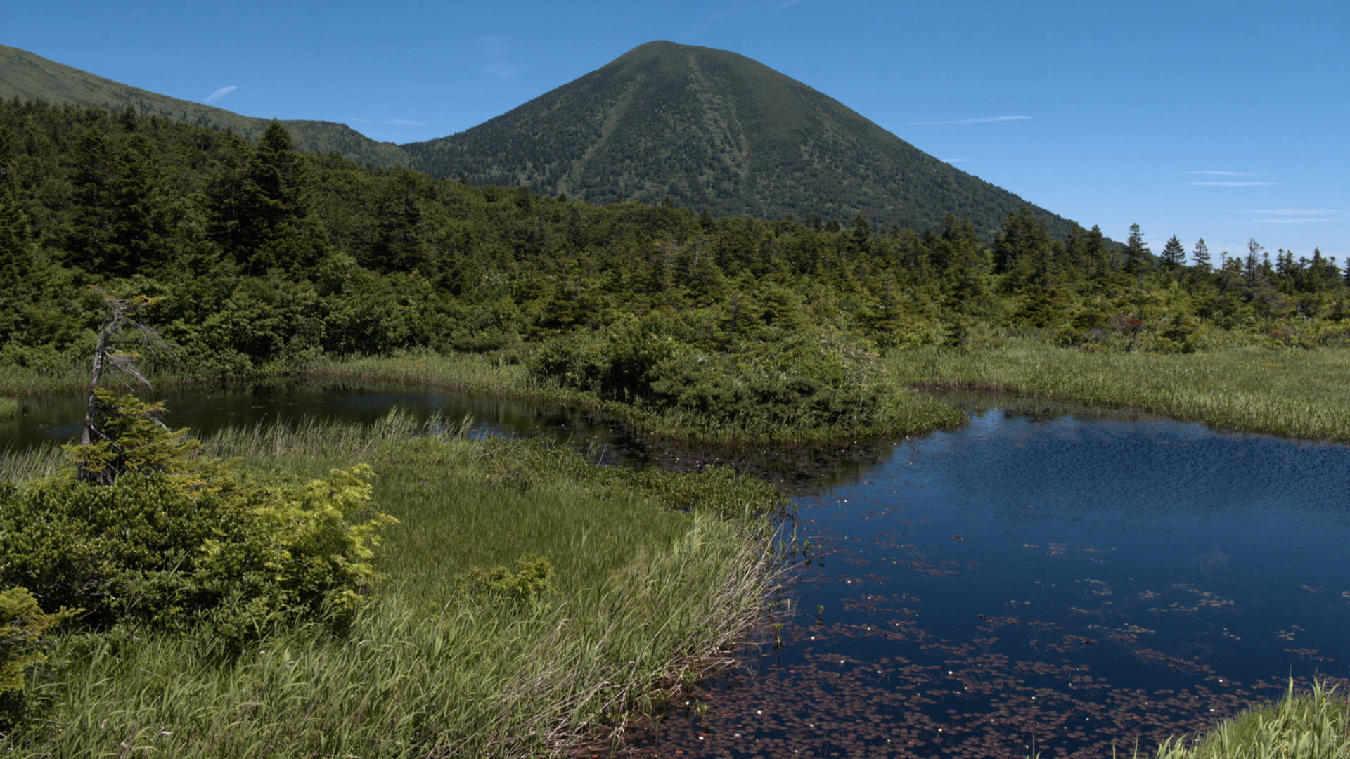
6. 스이렌누마(睡蓮沼) 늪 Suiren-numa Pond
핫코다 산맥 남쪽 곳곳에 분포하는 늪지대. 맑은 날에는 핫코다 산맥이 수면에 비쳐 환상적인 분위기를 자아낸다. 수면 위에 작고 하얀 꽃을 피우는 수련도 이 무렵 절경이다. 벤치에 앉아 하염없이 바라보고 싶어지는 풍경이다.
Various marshes are scattered to the south of the Hakkoda Mountains. The mountain range is reflected on the lake surface on clear days, creating a whimsical atmosphere. This is also the perfect time to see little white lily flowers floating on the water. Sit on a lakeside bench to take it all in.
Google Map